 °
°
 Go back to Red Rock Energy.

|
|
enclosure charger beam peet ground skywarn casi tecap GPSS GSPOT GPS Curioso Homepage Map Blast TopoZone Wildflower Productions Sam's GPS Raw Data Pages Des Newman's OziExplorer Page GIS Data Depot
 Enclosure
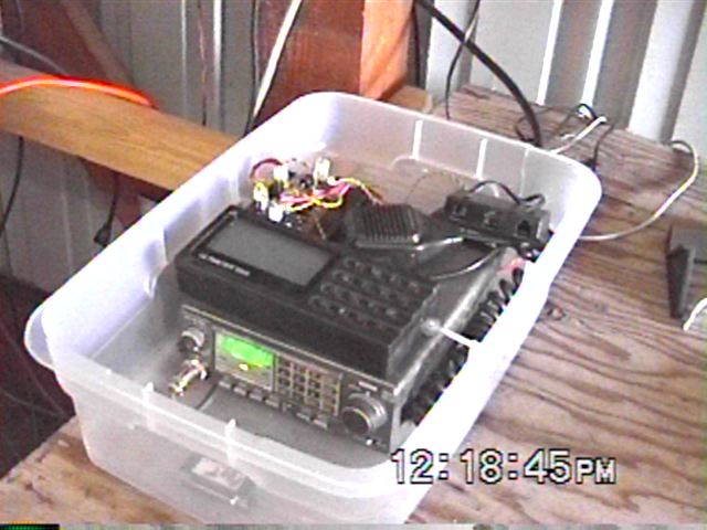
Kenwood 7930 transceiver, Peet Bros. weather monitor, and special charge controller all in a weather proof enclosure.
 Charge Controller
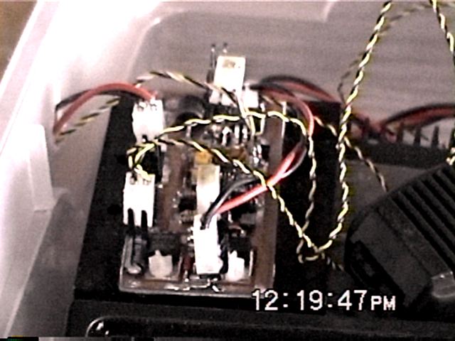
Special temperature controlled charge controller with under voltage cutoff.
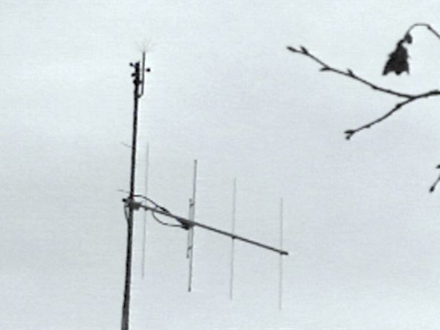 2 Meter 4 element Antenna.
 Peet Bros
Weather instruments and multi-point lightning arrester.
Mine is an Ultimeter 2000. A very nice weather instrument.
http://www.peetbros.com/index.html
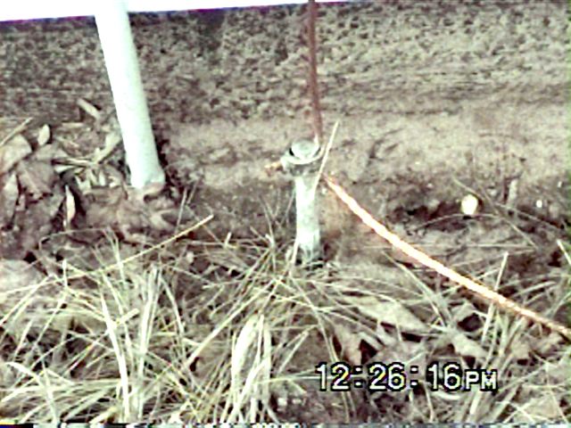 System Ground.
 Twin Cities Metro Skywarn Central
My Skywarn ID# is 1773
 CASI
CASI
Welcome to the CASI Weather Stations site.
http://www.weatherwatchers.org/wxstation/
This site has a good comparison of many of the weather stations.
 Tecnologia Aplicada
Home of the $79 Weather station based on designs by Dallas Semiconductor
http://www.aag.com.mx
gps
Global Positioning Equipment Equipment & Software.
GPS Software from Sunninghill (GPSS)
http://www.gpss.co.uk/
http://w3serv.com/webs/gps/index.htm
http://www.geocities.com/gpscurioso/
A utility to edit Garmin Mapsource files
http://www.mapblast.com/
http://www.topozone.com/
http://www.topo.com/
http://home-2.worldonline.nl/~samsvl/
http://www.powerup.com.au/~lornew/oziexp.html
http://www.gisdatadepot.com/
<redrok@redrok.com>